Glockner circuit: Long-distance hike in Austria (+Guide and GPX)
- Christian Sommer
- Oct 29, 2023
- 13 min read
Updated: Apr 4
The Glockner circuit (Glocknerrunde) is probably one of the most beautiful long-distance hikes in Austria. In seven days, you hike from hut to hut, covering around 135 kilometres around the highest mountain in the Alpine republic. Experience some of the most impressive views of the Hohe Tauern and marvel at the Großglockner from all sides. I found the tour simply magnificent - Chapeau!

Contents
1. Arrival
2. Route
3. Accomodation
4. Weather and best time to travel
5. Further information
6. Recommended stages
7. Hiking gear
8. GPX and map information
9. Conclusion
Glocknerrunde
In the heart of the Hohe Tauern National Park, the Glocknerrunde offers a unique nature and hiking experience. This magnificent mountain hike around the Grossglockner massif takes you between the impressive high mountain landscape and the cultivated mountain farming landscape that has been maintained for centuries. The daily stages of the Glockner Circuit are well marked and you don't have to cross a glacier or tackle difficult rocky passages. Nevertheless, you should not underestimate the route, as it leads into high alpine terrain. At the end of each stage, mountain huts or inns invite you to rest, refuel and spend the night. The alpine refuges are equipped and managed to meet simple needs. The often long access routes make it almost impossible to reach a higher level of comfort - and that's a good thing, as the original character of the huts is preserved. The circumnavigation of the majestic Großglockner connects the three federal states of Carinthia, Salzburg and Tyrol and guarantees you an unforgettable nature and mountain experience.
As always, I recommend my video of the tour:
Glockner circuit arrival
Plane: The best option is to take a flight to Innsbruck or Vienna and then continue by train to Zell am See. I highly recommend using Skyscanner to find cheap flights – it's a great app that gives you a quick overview of the best flight deals. Here you will find an overview of all the relevant airports for your journey.
Train: You can of course also travel to Zell am See by train alone. Then change to the 660 bus in the direction of Stausee Mooserboden. I highly recommend the OMIO app for booking bus and train tickets.
Car: You can also arrive by car and park your vehicle in the free multi-storey car park in Kesselfallstraße.
Bus: In Zell am See, take the 660 bus in the direction of the Mooserboden reservoir
There are alternative starting points: You can start the tour either at the free car park on Kesselfallstraße or at the Mooserboden mountain restaurant. Get off at the appropriate bus stop. If you start at the multi-storey car park, you can expect an extremely beautiful ascent along an adventurous mountain path to the Mooserboden mountain restaurant. From there, you have to continue up to the Heinrich Schwaiger-Haus, where you will spend your first night. Unfortunately, it is not possible to spend the night directly at the Mooserboden mountain restaurant, but the climb is definitely worth it!
If you take the bus directly to the Mooserboden mountain restaurant, you can spend your first night at the Berghotel Rudolfshütte. As an adventurous hiker, my experiences naturally relate to the starting point at the car park ;)

Glockner circuit route
On this tour, you can alternate between staying overnight in mountain huts and hotels. In total, you have to cover around 120 km and around 7000 metres in altitude. You have to alternate between staying in mountain huts and hotels. I completed the tour in seven days, which is very sporty. For connoisseurs, I would recommend at least 8 days. Technically, the tour is moderately difficult, with steep climbs, alpine paths and a few exposed passages. You need to be sure-footed and in good physical condition to complete this route.

Glockner circuit stages
The Glocknerrunde is a long-distance hiking trail around Austria's highest peak, the Großglockner. The stages lead through Alpine landscapes, breathtaking glacier regions and picturesque valleys. Below you will find the two best variants and their stages:
For connoisseurs:
Stage 1: Kaprun Stausee Mooserboden- Berghotel Rudolfshütte - 12km and 1000m ascent
Stage 2: Berghotel Rudolfshütte - Sudetendeutsche Hütte - 14km and 1200m ascent
Stage 3: Sudetendeutsche Hütte - Kals - 12km and 300m ascent
Stage 4: Kals - Glorer Hütte or Salmhütte - 14km and 1500m ascent
Stage 5: Salmhütte - Glocknerhaus - 7km and 300m ascent
Stage 6: Glocknerhaus - Fusch - 22km and 700m ascent
Stage 7: Fusch - Kaprun - 15km and 1600m ascent
Alternative (longer and more beautiful):
Stage 1: Kesselfallstraße car park - Heinrich Schwaiger House - 18km and 1500m ascent
Stage 2: Heinrich-Schwaiger-Haus - Berghotel Rudolfshütte - 15 and 1000m ascent (optional with Medelzkopf 2759m)
Stage 3: Berghotel Rudolfshütte - Sudetendeutsche Hütte - 14km and 1200m ascent
Stage 4: Sudetendeutsche Hütte - Glorer or Salmhütte - 14km and 1500m ascent (optional with Kastenegg 2811m)
Stage 5: Glorer or Salmhütte - Glocknerhaus - 7km and 300m ascent
Stage 6: Glocknerhaus - Fusch - 22km and 700m ascent (optionally with Spielmann 3029m)
Stage 7: Fusch - Kaprun - 15km and 1600m ascent


Glockner circuit accommodation
On the Glocknerrunde, you have to take turns staying in mountain huts or hotels. You can book directly via these links without costing you a cent more. Thank you very much!
Starting point: Kaprun
Stage 1:
Stage 2:
Stage 3: Kals
Stage 4:
Stage 5:
Stage 6: Fusch am Großglockner
Stage 7: Kaprun
Wild camping: Is unfortunately not allowed in the whole national park.

Glocknerrunde guide
Day 1: The hike starts at the car park in Kesselfallstraße. There is a bus station nearby where you can get off. You can park your car there for free during the entire hike. I hope you are motivated right from the start, because the hike begins with a strenuous climb. Firstly, it goes through the forest and then along steeply sloping rock faces (in my subjective opinion, with a fear of heights, minimally exposed but with rope insurance), as well as through numerous tunnels, until you reach the green alpine meadows of the Fürthermoaralm. There are numerous viewpoints here with benches and tables where you can take a rest. Then continue along the paths to the Mooserboden mountain restaurant. Now it's time to grit your teeth once again, as the final ascent to the Heinrich-Schwaiger-Haus follows. Enjoy Austrian cuisine and the magnificent sunset at 2750 metres - goosebumps are guaranteed!
Don't forget to take an emergency bivouac with you. It consists of an emergency blanket that is cold-resistant, a whistle and a mini compass. It should be in your rucksack on every hike anyway.
As the old Scottish saying goes: "There's no such thing as bad weather, only bad clothes!"

Since there is practically no shade and you are also exposed to the movements of the air all day, I would like to recommend you at this point immediately my beloved and specially designed for mountaineers Piz Buin Mountain sunscreen, as well as my ultra light sun cap and wind blocker
Furthermore, I would like to recommend my beloved Salewa trekking shoes because of the challenging mountain trails:
"Only where you have been on foot have you really been". Quote Johann Wolfgang von Goethe

Day 2: I got up very early so as not to miss the sunrise. The first morning light was already slowly filtering through the windows of the mountain hut and illuminating the room. I had to be careful not to wake anyone when I set off. The air was cool and fresh and all I could hear was the chirping of the birds and the sound of the wind. The colours in the sky gradually changed from dark blue to pink and orange, and the mountains and the landscape shone in golden light. I still remember how happy I felt at this magical moment. This moment of stillness and hope will hopefully also give you strength, because a full adventure awaits you on day two. You start with a descent on the same path back to the Mooserboden mountain restaurant. Keep left there and follow the path along the reservoir. There is also a passage secured by ropes, but this was manageable for me with a fear of heights. This is followed by the first major highlight: the adventurous crossing of the Kapruner Törl. At the top, a breathtaking panorama of the surrounding glacier with the evocative name ‘Unteres Riffkees’ awaits you. Then follow the path to the Berghotel Rudolfshütte.
Please note: There have been some changes to the route, so keep to the markings and pay attention to the signs.

Day 3: The Berghotel Rudolfshütte was really good for me. In addition to the delicious Carinthian cuisine, there was also a soothing infusion in the sauna. I think you will also recover well there. An incredibly beautiful high-altitude trail awaits you on this day. You hike along the Silesia High Trail to the Sudeten German Hut. The high-level trail is signposted with the trail classification RED.
If you still have enough energy reserves, I recommend starting early. That way you can take the surrounding Medelzkopf (2762 m) with you, which is practically right on the trail and offers a wonderful panoramic view. Your day ends at the rustic Sudetendeutsche Hütte.
I was surprised by a thunderstorm on the high trail. There was one second between thunder and lightning. Luckily, the time between lightning and thunder grew longer and the thunderstorm turned off! Thunderstorms can be dangerous, especially in the mountains. So follow the basic rules on behaviour during thunderstorms.

Day 4: I was very moved by the atmosphere at the hut. Hikers and mountaineers were everywhere - a really great feeling! The hut was nestled in a barren mountain landscape, surrounded by green slopes. The views down into the valley were simply breathtaking. Your hike continues through an impressive Alpine landscape, past mountain lakes and pastures, until you finally reach your destination for the day, the Glorerhütte. It's worth taking a break in Kals am Großglockner, a really charming little village where you will also find a supermarket. If you still have enough energy left, I recommend crossing the Kastenegg (2821 m), another magnificent summit. Your day then ends at the Glorerhütte or alternatively at the Salmhütte.
As there is hardly any shade on your trip and you are also constantly exposed to the air currents, I recommend my beloved "Piz Buin Mountain Sun Cream", which was specially developed for mountaineers, as well as my ultra-light sun cap and wind protection!
• Sun cap
"The sun also shines behind the clouds." Quote from Karl Friedrich Wilhelm Wander

Day 5: The fifth day will be something very special. You pass the reservoir and see the Pasterze, the largest glacier in Austria with a length of around 8 kilometres and also the longest in the Eastern Alps, which stretches out at the foot of the Großglockner. Your route continues through a barren mountain landscape until you reach the lower Pfandlscharte at 2663 metres. If you still have some energy left, you can take the nearby Spielmann (3027 m) with you - the summit is only a few hundred metres away from the lower Pfandlscharte. Afterwards, a wonderful descent to the Trauneralm awaits you.
Day 6: The sixth day is probably the least spectacular of the entire long-distance hike. You hike in the valley for a long time until you finally reach Fusch an der Großglocknerstraße. From there, the trail takes you back up into the mountains until you reach your destination for the day, the Gleiwitzer Hütte.
Tag 7: Von der Gleiwitzer Hütte wandern Sie im Zickzackkurs zur Brandlscharte, die auf 2371m liegt. Der Weg ist stellenweise etwas ausgesetzt und Sie müssen auch Ihre Hände benutzen. Danach folgt eine schöne Abstiegsroute zurück zum Parkhaus in der Kesselfallstraße. Haben Sie Ihr Ziel erreicht? Dann herzlichen Glückwunsch zu dieser Leistung! Ich würde mich über ein Feedback und Fotos freuen.

For optimal preparation for any tours I recommend the workouts on my Youtube channel:
Glocknerrunde best time
The best time for the Glockner tour is from July to September. Especially in July, however, there can still be old snow fields.
It should also be emphasised that the weather conditions at this altitude can often be extreme. Be it because of the cold and wind or because of the strong sunlight. I therefore recommend that you bring appropriate clothing, suitable footwear and sun cream.
Wind chill: Wind chill describes the feeling of cold caused by the wind. The higher the wind speed and the lower the air temperature, the greater the feeling of cold.

Glockner circuit further information
Thunderstorms: Note the behaviour during thunderstorms!
Old snowfields: It is a peculiarity of the spring season that the hiking trails at high altitude are often still dotted with steep snowfields. Alarm bells should always ring before entering a snow or firn field. A hiking trail that leads into a steep field of old snow can be reason enough to cancel a tour. If you want to continue anyway, you should at least have internalised a few safety recommendations. To cross a snow field, at least the top ten centimetres of the snow cover should be softened so that you can actually set footsteps. Good mountain boots with spikes or, even better, crampons are also a prerequisite!
Safety advice: Inexperienced mountain hikers should walk the Glockner circuit accompanied by a mountain guide. Until summer (July!), crossing hard old snow fields, especially in steep gullies, can be a great danger. Crampons or grödel should always be in your rucksack during this time!
Sure-footedness: The daily stages of the Glockner Tour lead along existing paths and climbs, however, in places up to high alpine terrain. In addition to good equipment and close observation of the weather situation, alpine experience, fitness and surefootedness are basic requirements for an enjoyable and safe tour of the Glockner. The daily stages involve differences in altitude of up to 3,000 metres (ascent and descent) and walking times of up to 8 hours.
Water: There is always water along the way. Either at wells, streams or huts. A water filter I would recommend as always.

Hiking gear
Here I recommend the most important hiking equipment that I own, have tested myself and have also bought myself. I pay a lot of attention to the weight and quality of my equipment. The equipment should simply feel good on longer tours and also be light. I can recommend the equipment for women because my wife uses it and it is basically the same as the equipment for men.
Note: Please keep in mind that the packing list is general and you will have to adapt it depending on the season and your needs!
Advertising note: These product links are affiliate links. If you buy something through one of these links, I will receive a small commission without you having to pay more. This is for the maintenance of my blog and you support me with my project, for which I am very grateful. Thank you very much!
Clothes
Hiking boots
Hiking shorts
Long hiking pants
Functional shirt
Hybridjacket
Fleece-jacket
Rain jacket
Functional underwear
Hiking socks
Other hiking equipment:
• Sun cap
Hiking backback (approx. 60 litres or as required)
by EXPED - unfortunately not available on Amazon.
• Backback - Ospray (was my old one and is also good)
Technology and orientation:
• Compass
• Headlamp
• GPS device or GPS watch if necessary
• Binoculars if necessary
Catering:
• Sweets to keep up morale :)
Health & first Aid:
• First Aid (small and light)
• Tape
• Bivouac
• Toilet paper
Other:
• Passport/Insurance certificate
• cash
• Gas cartridge
Film equipment:
• Camera
• Drone
• Tripod
• Clip

Glockner circuit GPX
The GPX files are available for download from the following providers:
Outdooractive: https://out.ac/vmPUp
Glockner circuit map

Long-distance hiking trails in Europe: 90 routes, all countries
Safety advice
Glockner circuit conclusion
The Glocknerrunde is a fantastic long-distance hike that offers an incredible amount. It shows a cross-section of the beautiful landscape of the Hohe Tauern National Park. I especially liked the sunsets and the glaciers. I really enjoyed the tour! I wish you a great time and much success ;)
As always, I would be very happy about a feedback on one of my channels.
Also feel free to leave me a comment.

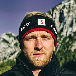
Hello, I am Christian, the chief globetrotter of this Site and an enthusiastic adventurer, hiker and filmmaker. I love to explore new paths and inspire people with them, and I love to share my hiking knowledge with you! You can also find my videos on YouTube! On my blog you can find tips for beginners and professionals on the greatest and most beautiful hiking tours there are. I want to encourage people to explore the world as a hiker, whether in the countryside, through the forest or in the mountains. True to the motto: If you haven't hiked, you haven't seen the world,
On my blog, I also write about hiking gear, the right summit training and nature conservation, as well as tips and information about hiking.


great tour