Cumbria Way: Ultimate guide with stages, accommodation, highlights and route
- Nov 25, 2025
- 24 min read
Updated: Jan 28
The Cumbria Way is a 122 km long-distance hiking trail through the heart of England's Lake District National Park, from Ulverston to Carlisle.
In this article, you will find all the information you need to plan carefully and hike safely on the Cumbria Way. I will guide you through each stage in detail and also show you exciting highlights along the route, places to stock up on supplies, accommodation and possible campsites.

Content
1. Journey
2. Route
3. Accommodation
4. Weather and best time to travel
5. Further information
6. Recommended stages
7. Packing list
8. GPX and map information
9. Conclusion
The Cumbria Way at a glance
Length: 112 - 122 km
Duration: 6 days, depending on stage planning and daily distances
Elevation: approx. 2,000 m in total
Difficulty: Technically mostly easy to moderate. In the middle section, there are a few mountain passes such as Stake Pass, boggy sections when wet, and longer distances between supply points. Good basic fitness and sure-footedness are recommended.
Landscape: Typical Lake District scenery with quiet valleys, clear lakes, high moors, green pastures, ancient stone walls and high hills.
Highlights: Coniston Water, Great Langdale, High Pike, Stake Pass, Borrowdale, Derwent Water and Keswick.
Accommodation: You will find hotels, B&Bs, hostels and guesthouses along all stages. In addition, there is at least one campsite on each stage.
Wild camping: Not officially permitted in England.
Best direction: Officially from south to north (Ulverston → Carlisle). However, the trail can also be walked in the opposite direction without any problems.
Requirements: Good sense of direction, some experience of longer daily stages and stamina for stages of up to 25 km. GPS tracks are useful – especially in fog or bad weather.
Typical starting point: Ulverston in the south at ‘The Gill’; the official end point is the historic city of Carlisle.
Waymarking: The Cumbria Way is marked, but not so well that you can completely rely on your smartphone navigation.
Best time to travel: May to October. May and June are particularly beautiful with fresh greenery, as is September with its autumnal atmosphere. In midsummer, the days are long, but it can also be quite busy.
Trail conditions: A mixture of hiking trails, forest paths, riverside paths, narrow climbs, river paths, forest roads and short asphalt sections in villages.

Cumbria Way Getting there
Getting to the Cumbria Way is straightforward and easy to plan. First, however, you should decide on a starting point. The Cumbria Way officially begins in Ulverston at the Cumbria Way Trailhead. The town is well connected to the public transport network and can be easily reached in several ways.
By plane
The easiest and often cheapest way to get there is via Manchester, Liverpool, Blackpool or Leeds. All of these cities have international airports with numerous direct connections from all over Europe. The nearest airports are:
Manchester Airport – approx. 2.5 hours by train (change in Lancaster)
Leeds Airport – approx. 3 hours by train (change in Lancaster)
Liverpool Airport – approx. 2.5 hours by train (change in Lancaster)
To find cheap flights, I highly recommend Skyscanner – a first-class app that gives you a quick overview of the best flight deals.
Onward travel by train
British Rail (National Rail) connects Manchester, Liverpool, Blackpool and Leeds directly with Lancaster. From there, regional trains run regularly to Ulverston.
The train also runs several times a day and takes only 39 minutes. I highly recommend the OMIO app for finding a train.
Return journey
The city of Carlisle, where your destination is located, has excellent public transport connections. The best place to start your return journey is Carlisle railway station.
Documents for entry
From 2 April 2025, all travellers will need a valid passport and an ETA (Electronic Travel Authorisation). The ETA regulation applies to all visitors who do not require a visa for short stays in the United Kingdom or who do not yet have British immigration status before their trip. You can easily apply for this via the "UK ETA App" or online at gov.uk. You will also find further information there.
As always, I recommend watching a video about the tour:

Cumbria Way route
The Cumbria Way stretches for around 122 kilometres through the breathtaking Lake District in north-west England. The trail is classified as moderately difficult, and it usually takes 5-6 days to hike the entire route. The Cumbria Way route is generally easy to moderately difficult and not particularly technical, making it ideal for enjoyable long-distance hiking. Only in very bad weather can individual sections of moorland become somewhat more challenging.
The origins of the Cumbria Way
The Cumbria Way was developed in the 1970s by the Ramblers Association and is now one of England's best-known long-distance hiking trails. The aim was to offer hikers a continuous, well-marked trail through the scenically and culturally diverse region – while promoting sustainable tourism in the Lake District. The trail runs almost entirely within the Lake District National Park and impressively conveys the natural and cultural soul of this unique region.
Waymarkings
The Cumbria Way is well marked, but not continuously. Yellow arrows and signs with the words ‘Cumbria Way’ on wooden posts and stones show you the way. Nevertheless, you should carry a GPS device or an offline map with you – this will help you stay on course even if the waymarkings are missing.

Remember to insure your trip well – because a fall or other typical hiking injury can quickly result in high rescue costs. Auras Insurance offers you worldwide hiking and trekking insurance, specially designed for active travellers.
Use the discount code HIKINGFEX to get 10% off your insurance.

Cumbria Way stages
The Cumbria Way is an impressive hike that takes you through varied landscapes in several stages. The stages offer unique views of the surrounding mountains, valleys and villages. The difficulty varies only slightly depending on the length of the route and the altitude difference:
Classic:
Stage 1: Ulverstone - Coniston (24 km and 600 m ascent)
Stage 2: Coniston - Great Langdale (18 km and 550 m ascent)
Stage 3: Great Langdale - Rosthwaite (11 km and 420 m ascent)
Stage 4: Rosthwaite - Keswick (13 km and 230 m ascent)
Stage 5: Keswick - Caldbeck (23 km and 900 m ascent)
Stage 6: Caldbeck - Carlisle (25 km and 190 m ascent)
Outdooractive: https://out.ac/3wqKBx
For the sporty:
Stage 1: Ulverstone - Coniston (24 km and 600 m ascent)
Stage 2: Coniston - Great Langdale (18 km and 550 m ascent)
Stage 3: Great Langdale – Keswick (24 km and 650 m ascent)
Stage 4: Keswick – Caldbeck (23 km and 900 m ascent)
Stage 5: Caldbeck – Carlisle (25 km and 190 m ascent)

Cumbria Way accommodation
There are several accommodation options along the Cumbria Way, ranging from charming guesthouses and hotels to B&Bs. You can book your accommodation directly here via my partner platform ‘Booking.com’ using the links below. It won't cost you a penny more. I have also compiled a list of all other accommodation and campsites for you.
Wild camping: Not permitted in England. However, there is a campsite at every stage.
Starting point: Ulverstone
Stage 1: Coniston
Coniston Hall
Stage2: Great Langdale
Stage 3: Rosthwaite
Stage 4: Keswick
Stage 5: Caldbeck
Stage 6: Carlisle

Cumbria Way guide
My experiences on the Cumbria Way are as varied as the long-distance hike itself. Here you will find a concise yet detailed overview of all the highlights and what to expect on your tour.
Getting there: Getting to the Cumbria Way was very straightforward. I booked a flight to Manchester – an international airport with numerous connections from all over Europe. Once I arrived in Manchester, I took the train (which runs several times a day) to Ulverston. The journey took about 1 hour and 40 minutes. When I arrived in Ulverston, I spent my first night in a cosy bed and breakfast – including a hearty English breakfast the next morning. Be sure to stock up on enough food in Ulverston, as the next reliable supply point is in Coniston at the end of the first stage.
Tips for Ulverston
If you have some time to spare, it's worth taking a leisurely stroll through the small town centre of Ulverston. The alleys are charming, the atmosphere relaxed and perfect for arriving before starting the Cumbria Way.
The Laurel & Hardy Museum, better known to us as ‘Dick and Doof’, is definitely worth a visit. Here you can immerse yourself in the life of Stan Laurel, who was born in Ulverston. Just a few minutes away you will also find his birthplace, which you can also visit.
Just above the town, the Sir John Barrow Monument stands on a hill overlooking Ulverston. The walk up is particularly beautiful – especially in the evening, when the sun slowly sets over Morecambe Bay and bathes the town in warm light. A perfect start to your hike through the Lake District.

Stage 1: Ulverstone - Coniston (24km and 615m elevation gain)
From the official starting point of the Cumbria Way in the district of ‘The Gill’, you leave Keswick and initially hike through gentle farmland and along easy paths through the foothills until you pass the beautiful stone church of St John the Evangelist's Church. With every kilometre, the landscape becomes hillier
After Beacon Tarn Lake, you have the option of taking a detour to the 255 m high Beacon Fell, which offers a beautiful panorama of the Lake District National Park. The view of Coniston Water opens up. The pretty village of Coniston and the striking peak of Coniston Old Man also appear on the horizon. With an extra day in Coniston, you can take a mountain tour (T2) to Coniston Old Man and explore the surrounding mountains. You can find the tour here!
After crossing the road, the path now leads along the lake shore. On your right, the densely wooded slopes of Grizedale Forest accompany you on the other shore. Further along the path, you will find the campsites just before Coniston if you are staying in a tent.
Tips for Coniston
Once you arrive in Coniston, it's worth planning some extra time. The place has more to offer than you might think at first glance:
Take a ride on the Steam Yacht Gondola
Visit the Ruskin Museum for insights into the history of the region.
Dine in a typical English pub
Visit the Parish Church of Saint Andrew
Walk to the Coniston Copper Mines
Walk to the Bluebird Cafe right on the waterfront
Supplies: There is a small shop in Torver. In Coniston, you will find plenty of options to stock up on supplies for the next day of hiking. We recommend the Coniston Foodhouse, where you can get snacks, fresh sandwiches and packed lunches. There is also a small supermarket.
Don't forget to take an emergency bivouac with you. It consists of an emergency blanket that is cold-resistant, a whistle and a mini compass. It should be in your rucksack on every hike anyway.
As the old Scottish saying goes: "There's no such thing as bad weather, only bad clothes!"


Stage 2: Coniston – Great Langdale (18 km and 550 m elevation gain)
You start the day with a gentle climb out of the village of Coniston. The route takes you through wooded hills and along beautiful lakeside paths. The first major highlight is Tarn Hows, which you can also walk around if you wish.
Before Skelwith Bridge, you can make a detour at High Park Farm to visit the beautiful Cathedral Chamber, which you can find here. Right next to it is the impressive Slater's Bridge. Further along the route – before Skelwith Bridge – a very short detour will take you to the Colwith Force waterfalls, which I have marked here. You will then pass through a few small villages and finally reach the village of Skelwith Bridge. This tranquil little village is about halfway along the stage, so it's a good place to stop for lunch at one of the small restaurants.
After Trevor Woodburn Bridge, you can make another short detour to Skelwith Force Waterfall. Then continue along the banks of the River Brathay to the village of Elterwater, where you will find several cafés and restaurants.
Almost directly on the trail is Elterwater Quarry, a heart-shaped lake that is definitely worth a visit. One village further on, in Chapel Stile, you can visit the stone Holy Trinity Church. Then continue along the river until you finally reach your destination: the tranquil village of Great Langdale, which welcomes you in the middle of the mountains with its hospitable inhabitants.
The wonderfully wide valley of Great Langdale unfolds here in all its glory – a real highlight on the Cumbria Way.
Tips for Great Langdale
Dinner in the bar or restaurant next to the Bunkhouse.
Places to stop for refreshments: You will find cafés in Skelwith Bridge, Elterwater and Chapel Stile. There is also a small village shop in Chapel Stile. Next to the Bunkhouse in Great Langdale, you will find a bar and a restaurant in the hotel.

Stage 3: Great Langdale - Rosthwaite (14km and 400m elevation gain)
It's best to have breakfast very early, as you have a long stage ahead of you. Detours are difficult with this length of route – but I'll mention them anyway for anyone who wants to re-plan the stage. You can expect a flat start through the quiet Mickleden Valley before climbing up Stake Pass.
The ascent to Stake Pass is not technically difficult, but it is quite challenging – especially in bad weather. Once at the top, you will be rewarded with a fantastic panoramic view: high moors, mountain ridges and the tranquil expanse of the Lake District spread out before you. There are many beautiful and rewarding mountain peaks to explore up here, but you will need at least one extra day to do so.
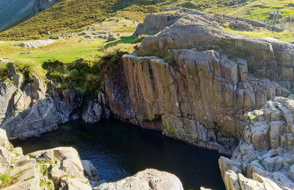
The trail then leads you down into the remote Langstrath Valley – a real natural gem. On the river path, you will pass Black Moss Pot, a rock hollow into which a waterfall flows. Where the river turns left, you will also find the Gordon Hallworth Memorial Bridge and the Galleny Force Waterfall. As soon as Borrowdale Valley opens up in front of you, you can continue your leisurely hike along the banks of the Derwent towards Rosthwaite, your destination for today.
Tips for Rosthwaite
A visit to the Flock-Inn Tearoom is well worth it – perfect for homemade cakes and a well-deserved break after the stage.
Take an evening stroll through the beautiful village with its charming stone houses and the relaxed atmosphere of Borrowdale Valley.
Places to stop for refreshments: You will find charming cafés in Rosthwaite, Grange and Portinscale. In
England isn't exactly known for lots of sunshine – but I still sometimes had it all day long. That's why, as always, I'd like to recommend my beloved Piz Buin Mountain sun cream!
"The sun also shines behind the clouds." Quote from Karl Friedrich Wilhelm Wander
Stage 4: Rosthwaite - Keswick (13 km and 200 m elevation gain)
This stage of the Cumbria Way is one of the more leisurely ones – perfect for taking a breather and enjoying yourself. You can plan a nice mountain tour here in the morning, for example to Grange Fell and Brund Fell, which are almost directly on your route. The 653 m high High Spy is also a worthwhile destination. However, this will add around 10 km and 700 metres of elevation to your tour.
After what we hope will be a hearty English breakfast, you will hike through the heart of the Borrowdale Valley, past ancient trees, babbling brooks and moss-covered dry stone walls. The landscape is green, peaceful and seems like something from another time. Shortly after Rosthwaite, the area around Castle Crag with the beautiful Millican Daltons Cave is also worth a visit.
The closer you get to the village of Grange, the more often you will be treated to views of the sparkling Derwent Water, one of the most beautiful lakes in the Lake District National Park.
In Grange, you can make a short detour to the picturesque Grange Bridge. The stone church in the village is also pretty to look at – you'll pass right by it. You'll also find a few cafés here for a short break. Tip: The paths on the 451 m high Catbells are also beautiful, with magnificent views over the lake. You can find the paths here!
Your route then takes you along the shore of Derwent Water through Brandlehow Park. In Portinscale, you cross the suspension bridge – a small highlight just before your destination. After that, it's not far to the lively town of Keswick.
Tips for Keswick
Visit the Derwent Pencil Museum
Walk to St John's Church
Stroll through Keswick town centre
Walk to Keswick Methodist Church
Stop briefly at the Frances Rolleston Fountain – a pretty historical detail.
Dine in a classic English pub serving regional cuisine.
Visit the Keswick Museum to learn more about history and culture.
Places to stop for refreshments: Keswick itself offers a wide selection of supermarkets, cafés and bars – perfect for stocking up for the next stage of your journey. If you don't want to stay overnight in Keswick, you could also visit Skiddaw House.
Due to the long distance and the strenuous altitude, I would like to take this opportunity to recommend my ultra-light hiking gear:
I would also like to recommend my beloved Salewa trekking shoes because of the mountain and jungle landscape and the challenging mountain trails:
‘Give a woman the right shoes and she can conquer the world.’ Quote from Marilyn Monroe

Stage 5: Keswick - Caldbeck (25km and 900m elevation gain)
Today, you will once again be heading high up into the mountains. You will cross the northern, mountainous part of the national park once more. After setting off from Keswick, the route initially climbs steeply towards Latrigg. Keswick's local mountain offers fantastic views over Derwent Water and the rooftops of the town right from the start.
Soon you will reach the car park below the Skiddaw massif. From here, the trail leads you into the Glenderaterra Valley, which winds spectacularly between the two famous mountains Lonscale Fell and Blencathra. The landscape here is wild, peaceful and surprisingly expansive.
After the secluded Skiddaw House, one of the most remote lodgings in England, the Cumbria Way splits into two variants: the high-level route and the low-level route. If the weather permits, you should definitely choose the high route. This is where you will reach the highest point of the entire Cumbria Way, High Pike at an altitude of 658 metres. The view is magnificent – on a clear day, you can see as far as the Scottish Lowlands.
Both routes eventually converge again and lead you further through the wide, open hills of Caldbeck Fell, an almost meditative landscape. The walk is pleasant but long. The solitude of this stage has a calming and soothing effect on the soul, but requires stamina and a good sense of direction. Finally, you reach Caldbeck, a small, tranquil village with friendly people and plenty of rural charm.
Tips for Caldbeck
Visit the abandoned site of The Howk / Bobbin Mill
The Roughton Stone with information sign
Visit St Kentigern's Church, one of the oldest churches in the region
Stop for refreshments at the Watermill Café
Food: There are no places to buy food or drink between Keswick and Caldbeck. You should therefore stock up on water, snacks and possibly a hot meal for the journey in Keswick.

Stage 6: Caldbeck – Carlisle (24.5 km and 190 m elevation gain)
Today, it's time to say goodbye to the Lake District National Park and the majestic mountains that have accompanied you over the last few days. The stage is long, but there is little elevation gain. It's best to set off very early after a good breakfast, as there is a lot to see in Carlisle.
The route follows the River Caldew, which accompanies you almost all the way to Carlisle. It's a brisk walk – pleasantly flat, mostly on well-maintained paths and prepared cycle paths. The change from alpine terrain to an open, wide landscape brings with it a whole new walking pace and allows you to cover the kilometres in a relaxed manner.
At the beautiful Rose Bridge, you can make a short detour to Rose Castle, an imposing building that is now used as an event venue. Immediately afterwards, you will pass the Lime House Private School, whose buildings also exude a typical English architectural style.
A little later, you will reach Dalston, where you can take a lunch break. Here you can take a deep breath and enjoy the last few kilometres at your leisure.
With every step you take, you get closer to the historic city of Carlisle – always following the river to your destination on the Cumbria Way. When you finally reach it: Congratulations! You have completed an extraordinary hike, with all its highs, challenges and quiet moments.
Tip: It's best to plan an extra day for Carlisle so you can take your time exploring the city.
Tips for Carlisle
Visit the mighty Carlisle Castle, which secured the border with Scotland for centuries.
The Carlisle Citadel with its striking towers.
Visit Carlisle Cathedral
Stop at the Market Cross Monument in the heart of the city.
Visit the Guildhall Museum for fascinating insights into the city's history.
Take a stroll through Carlisle Cemetery, which is surprisingly peaceful and atmospheric.
Visit the Museum of Military Life, which tells the military history of the region.
In the evening, enjoy a concert at the Old Fire Station
Places to stop for refreshments: There is a small shop in Caldbeck. In Dalston, there is a mini supermarket as well as several independent shops and cosy cafés. Ideal for refuelling or picking up a little souvenir to take home with you.

Cumbria Way best time to visit
The recommended time to visit the Cumbria Way is between May and October, with the most stable weather conditions usually occurring between June and August. During this period, you can expect long days, pleasant temperatures and the best chances of clear views in the higher elevations of the Lake District. April and May see the least rainfall. May and June are perfect for those who want to enjoy the trails in peace and quiet. Nature is at its most vibrant at this time of year: fresh green foliage, flowering meadows and the chirping of birds accompany you every step of the way. From September onwards, calm slowly returns to the valleys – the light becomes softer, the air clearer, and the landscape begins to take on its autumnal colours.


Cumbria Way – further information
Here you will find further important information about the Cumbria Way!
Gas cartridge: You can find one at Mountain Warehouse Altrincham in Manchester or, even better, at Mountain Warehouse Ulverston!
Money: ATMs and credit cards are accepted in many places. Nevertheless, you should take enough cash with you on your trip.
Luggage transfer: Book your luggage transfer here!
Tent: There is a campsite at every stage. You can find them in the ‘Accommodation’ section.
Wild camping: Not permitted in England.
Water: There are water sources in some places along the way, but they are not always reliable. I therefore recommend that you fill up your water supply at your accommodation before starting each day's stage. If you want to refill your water on the go, be sure to filter or boil it to be on the safe side.

Cumbria Way packing list
Here I recommend the most important hiking equipment that I own, have tested myself and have also bought myself. I pay a lot of attention to the weight and quality of my equipment. The equipment should simply feel good on longer tours and also be light. I can recommend the equipment for women because my wife uses it and it is basically the same as the equipment for men.
Note: Please keep in mind that the packing list is general and you will have to adapt it depending on the season and your needs!
Advertising note: These product links are affiliate links. If you buy something through one of these links, I will receive a small commission without you having to pay more. This is for the maintenance of my blog and you support me with my project, for which I am very grateful. Thank you very much!
Clothes
Hiking boots
Hiking shorts
Long hiking pants
Functional shirt
Hybridjacket
Fleece-jacket
Rain jacket
Functional underwear
Hiking socks
Other hiking equipment:
• Sun cap
Hiking backback (approx. 60 litres or as required)
by EXPED - unfortunately not available on Amazon.
• Backback - Ospray (was my old one and is also good)
Technology and orientation:
• Compass
• Headlamp
• GPS device or GPS watch if necessary
• Binoculars if necessary
Catering:
• Sweets to keep up morale :)
Health & first Aid:
• First Aid (small and light)
• Tape
• Bivouac
• Toilet paper
Other:
• Passport/Insurance certificate
• cash
• Gas cartridge
Film equipment:
• Camera
• Drone
• Tripod
• Clip

To prepare yourself optimally for your hikes, I recommend the workouts on my YouTube channel.
Long-distance hiking trails in Europe: 90 routes, all countries
Safety advice

Cumbria Way map
Here you will find a map of the Cumbria Way, which you can use to get a rough overview for planning purposes. For more detailed planning, I would recommend the maps from Outdooractive and Komoot.
Outdooractive: https://out.ac/3wqKBx

FAQ – Frequently asked questions about the Cumbria Way
In this FAQ section, you will find concise answers to the most frequently asked questions about the Cumbria Way. It will help you with your planning and clarify important points about the route, preparation, stages and special features of this classic long-distance hiking trail through the Lake District National Park.
What is the Cumbria Way?
The Cumbria Way is a 122 km long, multi-day long-distance hiking trail in north-west England. It leads from Ulverston to Carlisle, crossing the Lake District National Park with its lakes, valleys, moors and mountain passes. The trail combines alpine landscapes, historic villages and tranquil natural areas to create one of the most beautiful long-distance hikes in England.
How long is the Cumbria Way?
The classic route is around 122 kilometres long. Depending on variations, detours and summit tours, the distance may be slightly longer.
How long does the hike on the Cumbria Way take?
The Cumbria Way is usually completed in 5 to 6 stages. Depending on your pace and requirements, you can plan the tour to be athletic or leisurely.
Sporty: 5 days
Relaxed & enjoyable: 6–7 days
How difficult is the Cumbria Way?
The difficulty level is mostly easy to moderate. It becomes more difficult in bad weather due to:
longer climbs over passes such as Stake Pass
changing terrain
some lonely high altitudes
Sure-footedness and a good basic level of fitness are sufficient.
What is the landscape like on the Cumbria Way?
The Cumbria Way offers an enormous variety of landscapes:
green valleys and high moors
alpine passes in the Lake District
river landscapes and lakes
wide views over mountain ridges
The section through the Lake District National Park in particular is one of the most beautiful landscapes in England.
What are the highlights along the way?
Coniston Water
Great Langdale
Stake Pass
Langstrath Valley
Derwent Water
Keswick
Skiddaw House
Glenderaterra Valley
Caldbeck Fell
There are also many small waterfalls, bridges, valleys and panoramic peaks along the route.
Where can you stay overnight on the Cumbria Way?
Fixed accommodation: B&Bs, guesthouses, hotels in almost all stage locations
Hostels: especially in Coniston, Langdale and Keswick
Camping: possible at official campsites
Wild camping is restricted by law, but is usually tolerated at higher altitudes if you remain respectful (information provided without guarantee).
Are there trail markings?
Yes, the Cumbria Way is marked, but not extensively. In addition, navigation with GPX tracks on a smartphone or GPS device is recommended, especially in fog or bad weather.
What are the trail conditions like?
Forest paths
Narrow mountain trails
Grass and moorland passages
Short asphalt sections
Walking speed is often slower in the mountains in bad weather.
Are there supplies along the way?
There are supermarkets in Ulverston, Coniston, Keswick, Carlisle
Pubs and tearooms in Langdale and Rosthwaite
Few supplies between Langdale and Caldbeck
Plan snacks and water, especially for longer sections.
Is there water along the way?
There are many streams and rivers, but you should still filter your water or take enough with you. Do not rely on daily shopping opportunities in remote valleys.
What is the weather like on the Cumbria Way?
Spring & autumn: very good conditions
Summer: pleasant, but changeable
Rainy weather possible all year round
Rain jacket and windbreaker are important.
When is the best time to travel?
April – June: green, quiet, best conditions
September – October: clear air, little traffic
Midsummer is possible, but more touristy
What is the best way to get there?
Travel by train to Ulverston
Start directly in the district of The Gill
Return journey from Carlisle with train connections in all directions
What equipment do you need?
Hiking boots or trail runners
Rain jacket
1.5–2.5 l water carrying capacity
Smartphone with offline maps
Snacks
Possibly trekking poles
Tent only necessary if you want to camp.
Are there any particular hazards?
Fog at high altitudes
Wet and slippery rocks
Weather changes
Lonely passages
There are hardly any technically difficult sections, but orientation is important.
Is the Cumbria Way suitable for beginners?
With some hiking experience, the Cumbria Way is easily manageable. For complete beginners, it is advisable to plan shorter stages
.
Can you hike the Cumbria Way alone?
Yes, the Cumbria Way is suitable for solo hikers.
You will regularly pass through villages and meet other hikers.
What makes the Cumbria Way special?
The focus is not on speed, but on:
experiencing quiet valleys
discovering the British mountain landscape
enjoying pubs and tearooms
including detours to the summits
taking your time and walking mindfully
This is exactly what the Cumbria Way is made for.
Provisions along the Cumbria Way
Stage 1: Ulverston (starting point)
Supermarkets, bakeries, outdoor shops
Perfect for buying all your starting provisions.
Stage 2: Coniston (village)
Small supermarkets, cafés, pubs
Good opportunity to stock up on snacks and daily provisions.
Stage 3: Great Langdale / Elterwater (valley villages)
Hotels, pubs, small shops
No large supermarket, but food and lunch are readily available.
Stage 4: Rosthwaite (Borrowdale Valley)
Tearooms, lodges, small shops
Ideal for lunch breaks, cakes and simple supplies.
Stage 5: Keswick (town)
Large supermarkets, outdoor shops, bakeries, restaurants
The best place on the Cumbria Way to restock completely.
Stage 6: Caldbeck (village)
Small village shop, café, pub
Supplies available, but selection limited – plan ahead.
Stage 7: Carlisle (destination)
Large town with all shopping facilities
A great finish with restaurants, shops and supermarkets.
The most beautiful stages of the Cumbria Way
The most beautiful stages of the Cumbria Way definitely lead through the Lake District National Park. Particularly rewarding are the sections from Langdale to Rosthwaite via Stake Pass and the stage from Rosthwaite to Keswick along Derwent Water, which perfectly combine alpine scenery, quiet valleys and magnificent lake views.
Cumbria Way start
The Cumbria Way starts in historic Ulverston. From the official starting point in the district of The Gill, you begin your hike on this traditional long-distance trail. A stone monument marks the official starting point.
Cumbria Way distance (Cumbria Way length)
The Cumbria Way covers about 112 - 120 km (73 miles) through the Lake District, running from Ulverston to Carlisle.
Cumbria Way Wild Camping
Wild camping on the Cumbria Way is generally possible, but only if you observe the ‘Leave no trace’ rules and show consideration for private property. You will find suitable, quiet spots, especially in the more remote sections between Langdale and Caldbeck. Pay attention to weather conditions and water supplies – and if in doubt, always ask politely (information provided without guarantee).
Cumbria Way Camping
Along the Cumbria Way, you will find at least one well-equipped campsite on each stage. These offer a comfortable base to rest and recharge your batteries. You can find an overview of all campsites and other accommodation options in the ‘Accommodation’ section – so you can plan your tour with complete peace of mind.
Cumbria way in 7 days
For the Cumbria Way in 7 days, you will need to split up the last and longest stage of the trail again. There are numerous accommodations that you can book halfway along the route. The best way to do this is to use Booking.com.
Cumbria Way baggage transfer
Book your luggage transfer here! Luggage transfer on the Cumbria Way is offered by several local providers, transporting your bags between accommodations each day. This service allows you to hike with only a daypack, making the route more comfortable and accessible for walkers of all experience levels.

Cumbria Way
The Cumbria Way in northern England is a 112-122 km long-distance hiking trail that leads through some of the most beautiful landscapes in the Lake District. You can expect an impressive mix of quiet valleys, clear lakes, vast moors and gentle mountain slopes. The trail is well signposted and ideal for hikers of moderate fitness – stages can be easily adjusted depending on length and elevation profile. Look forward to a great time in one of the most charming hiking regions in Great Britain – and good luck on your journey!
As always, I would be very happy to receive feedback via one of my channels.
You are also welcome to leave me a comment here.

Hello, I am Christian, the chief globetrotter of this Site and an enthusiastic adventurer, hiker and filmmaker. I love to explore new paths and inspire people with them, and I love to share my hiking knowledge with you! You can also find my videos on YouTube! On my blog you can find tips for beginners and professionals on the greatest and most beautiful hiking tours there are. I want to encourage people to explore the world as a hiker, whether in the countryside, through the forest or in the mountains. True to the motto: If you haven't hiked, you haven't seen the world,
On my blog, I also write about hiking gear, the right summit training and nature conservation, as well as tips and information about hiking.


Comments